Glacier National Park Backpacking Trip, July/August 2005: Pre-Hike Stuff
Added 18 September 2005
Pre-Hike | Red Rock Lakes NWR kayaking | Clearwater Canoe Trail kayaking | Day 1 | Day 2 | Day 3 | Day 4 | Day 5 | Day 6
The main goal of the trip was a 7 day/6 night backpacking trip with my wife (Shannon) and my boss and his wife (Jerry and Andrea), but Shan and I figured since we're driving all the way up there, we might as well take a little extra time and do some exploring in Montana.
The trip started out with a marathon drive. But the marathon drive was itself preceded by another marathon trip.
After having flown out to Kentucky early Friday morning to spend a couple of days at my family reunion, I returned Sunday evening and got back to Tucson with just enough time to go home and grab a bite to eat before Shan and I had to head out for our soccer game Sunday night. Despite playing short-handed, we managed to win 1-0. Then we rushed home to get the car packed up and take care of all of the last-minute tasks before the trip. I was up past midnight with last-minute items.
Shan had a hard time getting to sleep on Sunday night, so I agreed to push our wake up time back to 6:00 Monday morning. She ended up getting up before six o'clock, so she woke me up and we got the last of the packing done. After a stop for ice and gas, it was seven o'clock before we got rolling, an hour behind when I had originally hoped to be on the road.
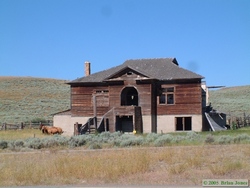
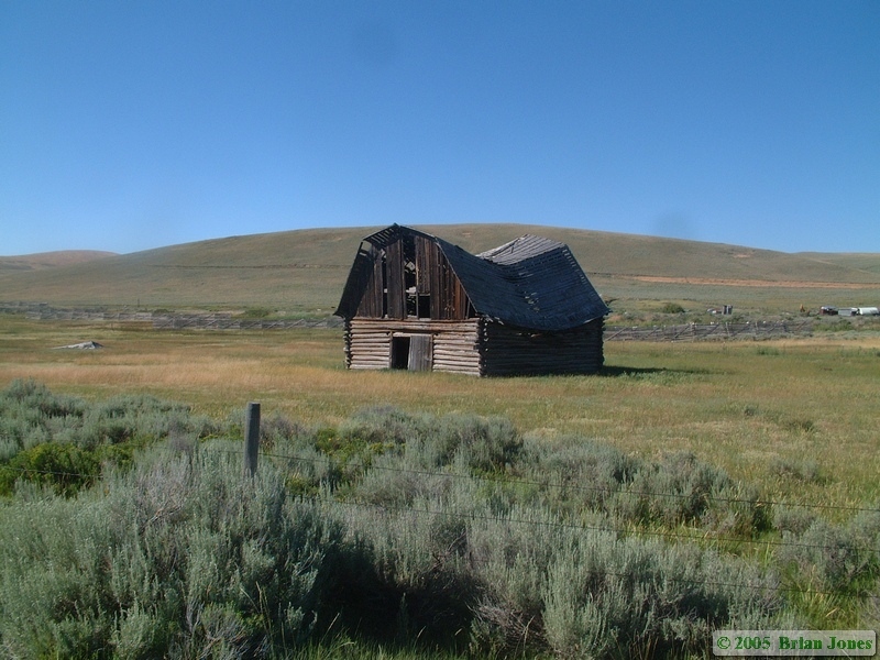
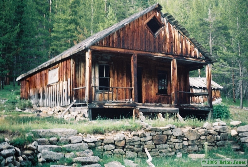
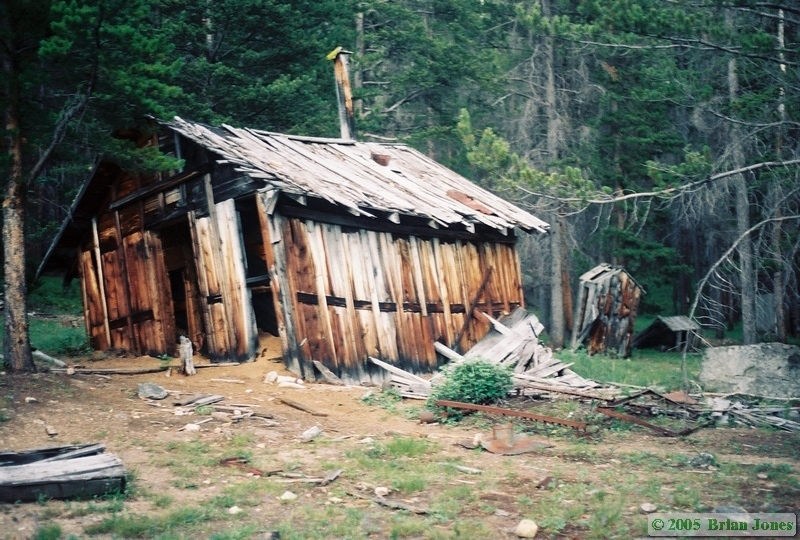
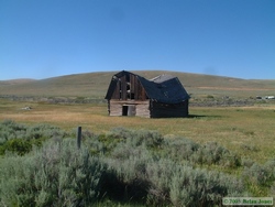 Our drive north was quite smooth and uneventful, but still long. Except for one fairly short slow-up in Phoenix due to an accident, we made excellent time, and made it the 975 miles to Pocatello, Idaho in 15 hours, where we quit for the day. The next morning we had the free continental breakfast and hit the road by around 7:30. We continued north to Monida, which is right on the border between Montana and Idaho (get it? Mon-Ida?). From there we left the interstate and hit the dirt, heading east to Red Rock Lakes National Wildlife Refuge. It was from the border onwards that we discovered that Montana is the Derelict Building Capital of the World. They are the same time sad and fun.

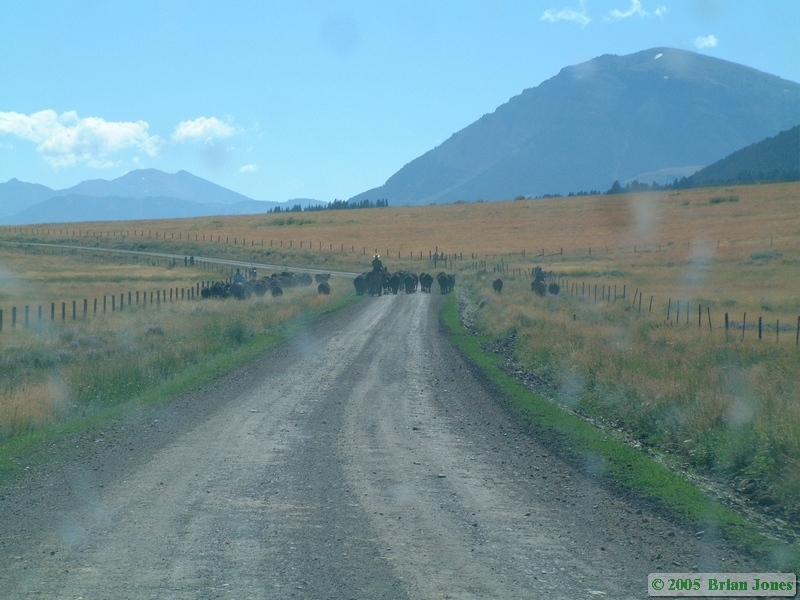
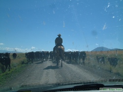 Along the way, we got to participate in a cattle drive. Yee haw! Three cowboys (well, two cowboys and a cowgirl) were driving about a hundred head of cattle down the road to the refuge. The cattle didn't want to get off the road, so one of the cowboys had to drive straight through them, telling us to stay right behind him. Then he spurred his horse into a run and dove right through the herd, with us hard after him.
Since the two excursions we made in the kayak are worthy of their own pages in my "On the Water" section, I'll save space here and ask that you follow the following link to hear more details about our paddle adventure around Red Rock Lakes National Wildlife Refuge for more all the details of that part of the trip.
We paddled around the lake for several hours and by mid-afternoon we pointed the boat towards the car and ended our first paddle in the new 'yak. As we headed back to the main road, we saw three herds of pronghorn antelope totaling about 18-24 individuals.
On the road back to the highway, we saw more deer and a coyote, and the car began a reputation that would earn it the nickname "Bird Slayer," as we hit and killed a poor little sparrow. Back on the interstate we headed north, looking but failing to find someplace to find a quick dinner in Dell, but we ended up in Dillon. From there, we had to back-track to the highway that would take us across to Jackson and the Jackson Hot Springs Lodge. It was on this highway that our car solidified the "Bird Slayer" moniker.
As I was driving along a straight stretch of highway, I saw on the road ahead a quail-like bird crossing the road at a speed that would easily get it off the road before I made it to that point. I then saw her brood of what must have been at least 15 tiny chicks trailing along behind her. They were stretched from one side of the two-lane highway all the way to the other. I knew I couldn't stop in time and didn't have anyplace to go to miss them. I aimed as best I could to avoid as many as I could, and it looked like I had succeeded when I looked in the rear view mirror. I stopped anyway just to make sure, and Shan got out of the car and ran back. As I backed the car up I could see a little bird flopping in the road, just as another car started to approach. Shan, not knowing what else to do, and not wanting the little guy to suffer, stepped on it to end its misery. After the other car passed, I continued backing up to get Shannon. I ended up hitting three of the poor little things. I checked on the other two, one was definitely dead, the other was also only mortally wounded, so I drove over it to put it out of its misery, then drove over the one that Shan stepped on just to make sure it wasn't suffering. We both felt horrible.
After the Upland Game Bird Massacre, we went out in search of the ghost town of Coolidge. Unfortunately, I had forgotten to bring the map I had of the location of the ghost town, so I had to go from memory. At first I thought I was on the wrong road, but eventually we came to a construction zone, and I verified that we were on the right road with the flagman and got excellent directions from him on how to find Coolidge. The construction zone itself was rather amusing. The road that we were traveling was dirt, and I imagine only saw perhaps a half-dozen cars per hour when it's busy, no work was being performed at the time (after 8:00 p.m.), and not only that, but the new route was a detour along which no work was being performed at all, yet there were two flagmen and a pilot car driver manning the construction zone 24 hours a day. It was rather bizarre.
And unfortunately, we got there just as the pilot car left, so we had to wait about 10 minutes for it to return bringing a lone car safely through the non-construction zone. (Phew! Another disaster averted!) The 10 minutes was far more time than I needed to verify how to get to Coolidge, so the remainder of the time was precious and waning daylight wasted.
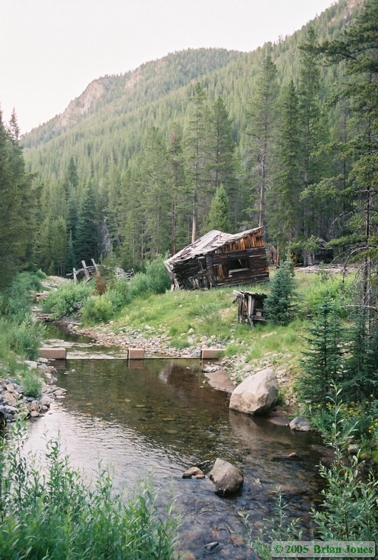
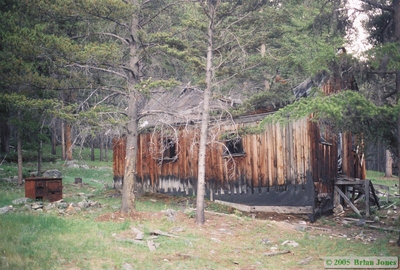
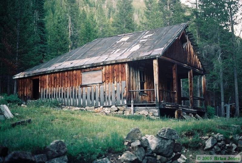
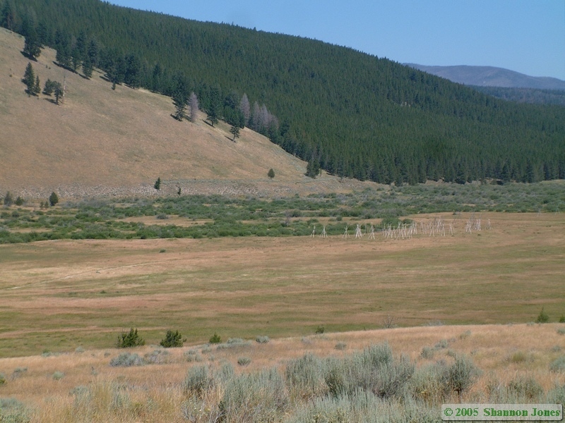
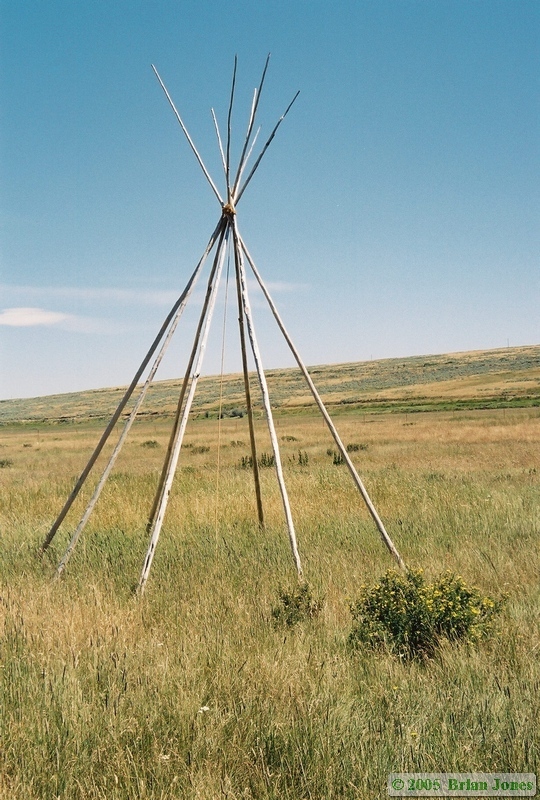
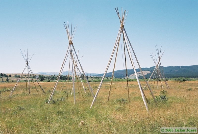
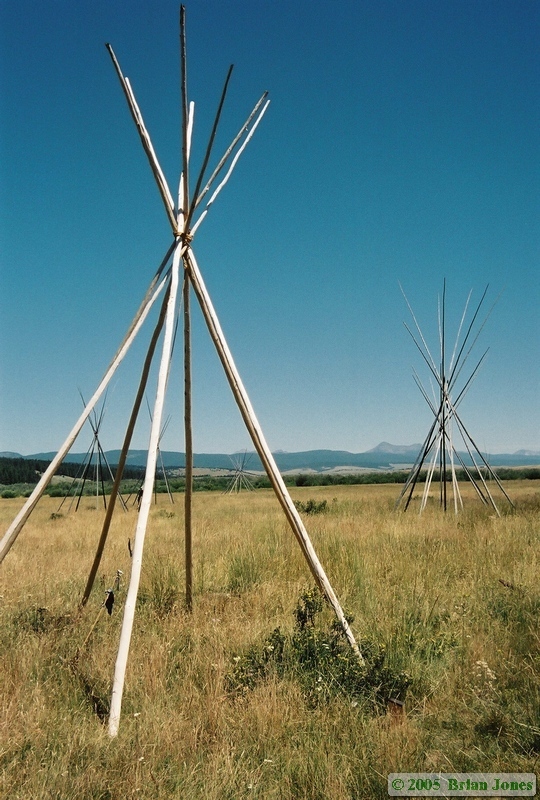
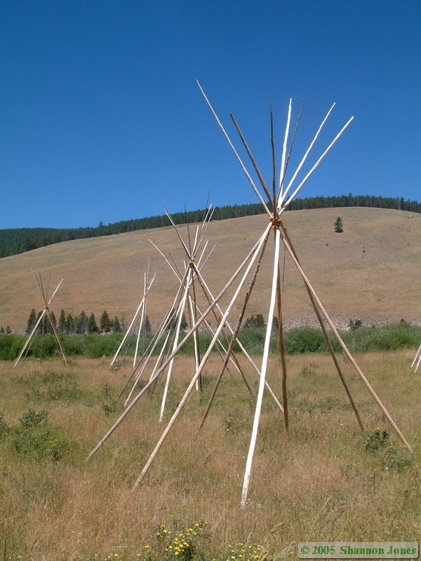
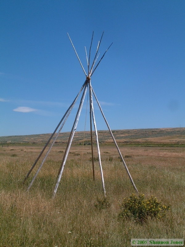
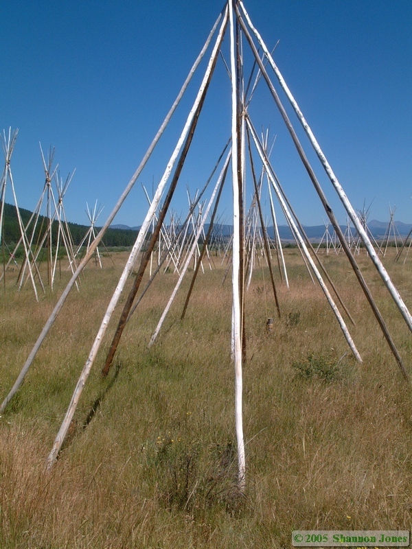
We made it to the apparently fairly new parking lot about half-mile away from Coolidge as the sun went down, and quickly started hiking. Just as we started hiking, we passed two older women hiking out, who said that the sign was wrong and the town was quite a bit further than half a mile away. One of the women had a bucket and a small digging tool, and I figured they had been doing some rock hounding at the mine near the town.
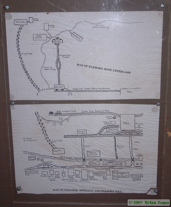
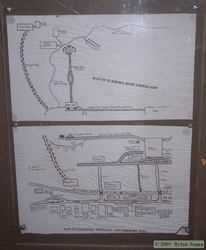 Undaunted by the woman's comment, we kept going, for what I estimate to be pretty close to half a mile. The day was fading fast so we scurried around to see what we could see and get what pictures the available light would allow. Fortunately I brought my fast 50mm prime lens for the SLR, but unfortunately I didn't grab my tripod, so I was somewhat limited in the shots I could reasonably get. One really nice touch was a map posted at the beginning of the town so that you could tell what most of the buildings were.
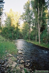
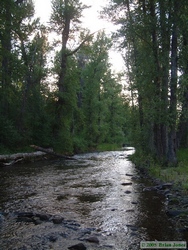
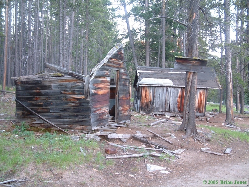
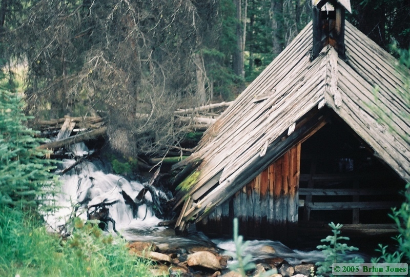
At any rate, Coolidge was definitely worth the effort and time of finding. Some of the buildings are remarkably intact, and even Shan was happy that we went (she was skeptical), despite it making for a really late night. In addition to the interesting nature of the town itself, area in which Coolidge was built is wonderful. It is in a nearly pristine forest area and a beautiful little creek runs the entire length of the town. One building had fallen into the creek, making for an interesting image.
Shan said that while she was roaming around the town, she saw some recent diggings amongst the buildings and thought that perhaps the women weren't rock hounding at all. If they were artifact hunters, I am really upset. I hate it when people loot historical sites.
On the way back to the car, we jogged part of the way while we still had a tiny bit of light left. By the time we got back to the car it was very nearly dark, and we wasted no time in high-tailing it back to the main road and our lodgings for the night. We had better luck with the on the way back and the pilot car was on our side just waiting to take us through the non-construction zone. When we reached the other side, I thanked the flagman who had helped us with directions to Coolidge and we went on our way.
We didn't make it to Jackson Hot Springs Lodge until after 10:30 p.m., and the proprietor was about to give up on us and just leave us a note telling us which room was ours. We quickly settled in to our room, showered, and had hot drinks before retiring to bed.
We got somewhat of a late start on Wednesday. It took us a while to get up and get moving to begin with, then we went over to the lodge restaurant for breakfast. We both had juevos rancheros that came with service that was every bit as equal to the food, which was phenomenal. It was then that we learned that the area had experienced a 5.7 magnitude earthquake Monday night. We would have been approaching Pocatello, Idaho at the time, so didn't feel a thing. Along the way, I took interest in what I had discovered were called "beaver slides." Apparently, they were used to stack loose hay, and horses would be used to slide the hay up the beaver slide, but information about them isn't abundant on the web, so I'm not sure if that is completely accurate or not. I did find this picture of one in use though.
Our first stop of the day on Wednesday was Big Hole National Battlefield, someplace I dearly wanted to visit from the moment I first read about it while researching this trip. Big Hole is a site along the Big Hole River where, on August 9, 1877, the U.S. Army Seventh Cavalry under the command of Col. John Gibbon attacked and massacred the sleeping Nez Perce camped there. 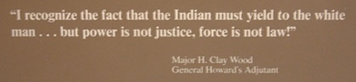 The highly abbreviated version of the story is that the Nez Perce had been forced to move to a smaller reservation and were doing so, when a Nez Perce warrior lead a small group of warriors in the killing of some settlers as revenge for the murder of his brother by those same settlers. The Nez Perce were camped at White Bird Canyon and the Army went there to get the Nez Perce who were involved in the killings. The Nez Perce greeted the U.S. Army peacefully under the white flag of peace. One of the trigger-happy whites shot at the Nez Perce and a battle broke out. After that, the Nez Perce ran in fear, and the army pursued. The Nez Perce ran all the way to Montana Territory, thinking that the Army wouldn't follow them there. They were quite mistaken.
The Army caught up with them at the Big Hole River camp, and a series of events lead to the army firing upon and charging into the camp of the sleeping Nez Perce, killing, both intentionally (and brutally) and unintentionally many women and children along with the men. The Nez Perce were able to rally and fight the Army off and make their escape, but many Nez Perce were killed, and the battle was one of the last they would fight before the tribe split in two and either surrendered or escaped into Canada.
At the visitors center, we watched a movie about the Big Hole battle that was refreshingly sympathetic towards the Nez Perce. It was nice to see a portion of the U.S. government acknowledging one of the many great atrocities performed in its name against one of the many groups of people it has wronged.
 After watching the movie, we went down the hill to the battlefield site, where there are trails to the site of the Nez Perce camp and the U.S. Army siege area and the location of the howitzer position on the hill. There were perhaps a half dozen cars in the parking lot, but while we hiked the trail to the Nez Perce camp site, we didn't see or hear a single person. I hope dearly that this observation of apparent disinterest in the Nez Perce side of the tale is not borne of any lack of interest, a general feeling the white side is the right side or good old fashioned barely hidden bigotry.
My general feeling while walking around the battlefield was one of profound loss. It is a powerful and haunting place.
After Big Hole Battlefield, we headed northwest, crossing the Big Hole Valley and entering the Bitteroot Valley. Along the way we passed through Darby. Thankfully. I had planned on stopping in Darby for something or other, but as we entered the town, there was a rather large sign on the side of the highway that said something to the effect of "Stop Grizzly Reintroduction." Although I'm sure that not everyone in the town was anti-grizzly, I had no intention of spending my money in a place where such anti-grizzly sentiments were so openly displayed. We ended up stopping in the next town of Hamilton, which may have been no better. I dropped Shan off at the grocery store while I gassed up, and at the gas station I saw a bumper sticker that said "Save an elk, kill a wolf." The Bitteroot Valley, though picturesque, was not wholly winning me over.
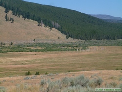
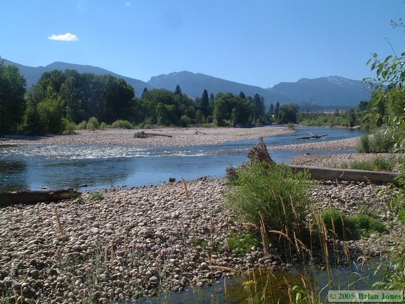
 After Hamilton, we headed to the Teller Wildlife Refuge, the only private wildlife refuge in Montana. We got there in the early afternoon and stopped at the headquarters where Tami helped us out. We signed a waiver and she gave us a map of the public trail in the refuge, which roughly followed the Bitteroot River. It being mid-afternoon, we were not there at an ideal time to see birds or wildlife, but we did the short three-mile hike anyway. It was well into the 90's, and it seemed like the Mountain chickadees were the only creatures besides us out braving the heat.
After our hike, we headed back south to our night's lodgings at Deer Crossing B&B. When we got there we were greeted warmly by Stu, who showed us around the house and got us set up. Our room was on the small side, but had a private bath and a private porch, where we ate a simple but pleasant dinner out of food that we had brought. Stu and Linda have a number of acres, including a pond, which we didn't have the time to check out.
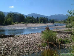
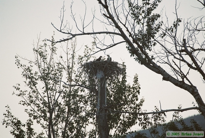
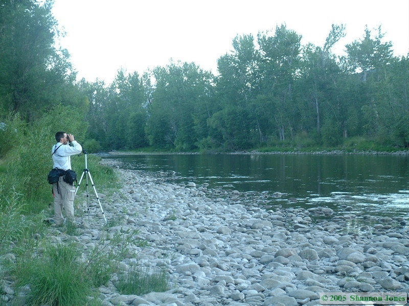
Instead, we took Stu's advice and went down to the Bitteroot River near Angler's Roost to check out an osprey nest that is right near the highway. We set the spotting scope up on the nest and got a good look of the adults and their young, which looked to be just about ready to fledge. We also saw Eastern kingbird, killdeer, Great blue heron, Mountain plover, Semipalmated plover, mountain chickadee, American robin, Black-billed Magpie, Red-naped Sapsucker, and Barn swallow. Both Shan and I were a bit surprised, and admittedly disappointed that we didn't get to see more species of birds. Shan did have fun chasing a deer around the river overbank with the camera though.
On Thursday morning, the B&B's cook, Linda, made us a tofu scramble and homemade hash browns for breakfast. 
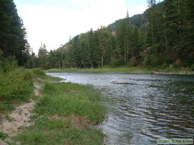
 It was a wonderful way to start the day. After breakfast, we high-tailed it north to the Clearwater Canoe trail. It took a little longer than expected to get there, but the drive crossed some beautiful terrain. I especially enjoyed the Blackfoot River valley. Once again, we arrived to our destination in the middle of the day, and clearly out of the prime time for seeing wildlife, but we went to the Clearwater Canoe Trail trailhead and started to get the kayak ready for our paddle. There was only one other vehicle in the trailhead parking lot, and we relished the idea of at least having the whole place to ourselves. Just as we were getting pretty close to getting ready to launch, an outfitter showed up and quickly unloaded a bunch of canoes right into the launch area.
Click the link in this sentence for the rest of the story and pictures on the Clearwater Canoe Trail adventure.
Once back on dry land, we pulled the boat up into a shady area and I set out on the mile-and-a-half hike back to the car. Along the way I stopped briefly at a wildlife blind in a marshy area and saw a Great blue heron and a deer. The whole trail was through a beautiful wooded area. I then drove back to Seeley Lake to get Shan and the boat. On our way out, we stopped in at the ranger station where Shan inquired about seeing bald eagles. Her latest obsession seems to be a desire to see a bald eagle.
I had planned on taking a dirt road which cuts across to Highway 93 in order to make a loop as we headed back to the Missoula area, but the ranger didn't recommend it unless we had a lot of time, since the road was not very good and would be slow. I was still game to try it, but knew it was a losing battle to even think about it when the ranger said there was an eagle that could be very reliably seen on a particular tree back the way we had come from. Shan just had to see it. So we re-traced our steps south. When we got to the eagle tree, there was, almost laughably, no eagle on it, but we decided to wait a bit. We weren't disappointed. The eagle soon appeared, first soaring hither and thither before alighting on the tree exactly as predicted. It wasn't good enough for Shan though, as it didn't have the full adult plumage, so it looked more like a Golden eagle. So, needless to say, she is still obsessed with seeing an "eagle."
After watching the eagle for a while, we headed back to Missoula for dinner, then continued west to get to our lodging for the night. It was our anniversary, so Shan had wanted someplace really special.  Jan, the woman who runs the Running Horse B&B, told Shan on the phone that she occasionally sees wolves. That was all Shan heard. So even though Running Horse was backtracking fairly significantly from Seeley Lake, that's where we headed Thursday night. Running Horse is about 11 miles from the interstate, but it feels much further.
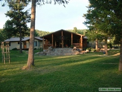
 Of course, that feeling may be due in part to the fact that we passed it the first time up the road because it isn't signed very well. Though it is certainly off the beaten path, with about 6 miles of dirt road to get to it. The drive is definitely worth it though. The B&B is beautiful both inside and out and our room was large and very well done. It sits on a fair amount of acreage and enjoys a stretch of Ninemile Creek in the back. The only (very minor) problem we had was a rather rambunctious Blue Healer named RD.
 Jan, the inn keeper, was an extremely friendly and talkative person. She's very nice, and I enjoyed the conversation, but it was also our anniversary and we'd had a long day, so Shan and I wanted to enjoy a quiet evening together. Once we were alone, we spent the waning evening on a little hike down to the creek and beyond. It was a very pleasant little hike, but we didn't see much. We saw some American robins, Red Crossbills, an American dipper, and several deer.
When we got back to the B&B, I showered and Shan drew a bath in the large whirlpool tub. After my shower, I decided to join Shan in the tub, relax and enjoy some sparkling cider, but trouble was afoot. Shan had put bubble bath and some sort of effervescing grains in the tub. When we turned the jets on, the bubbles formed, and formed - and FORMED. Within minutes the bubbles were overflowing the tub, and kept rising even though we turned the jets off. So we started to drain the tub, but the bubbles just kept on rising, now more than a foot over the top of the tub, up to our necks and still rising. So less than 10 minutes after getting into the tub we had to abandon ship and take showers to wash all of the bubbles off of ourselves. After the bubble fiasco, we escaped to the bedroom and had some sparkling cider before going to bed.
On Friday morning, we planned on leaving Running Horse at around 6:30 in the morning because we had about a four hour drive ahead of us to get to Jerry's property, where we were meeting he and Andrea. We didn't get out the door until after 7:30, with some delicious fresh peach juice in our bellies and a super-sweet homemade blueberry coffee cake in our hands for the road. Our first sighting of the day was a wild turkey on the way to the interstate.
 We ran into a couple of construction zones on our way north up the Flathead Valley towards Glacier and Jerry and Andrea's property, so we didn't arrive there until around noon. Once you leave "civilization," it is a long and winding road to get to Polebridge and beyond to their place.
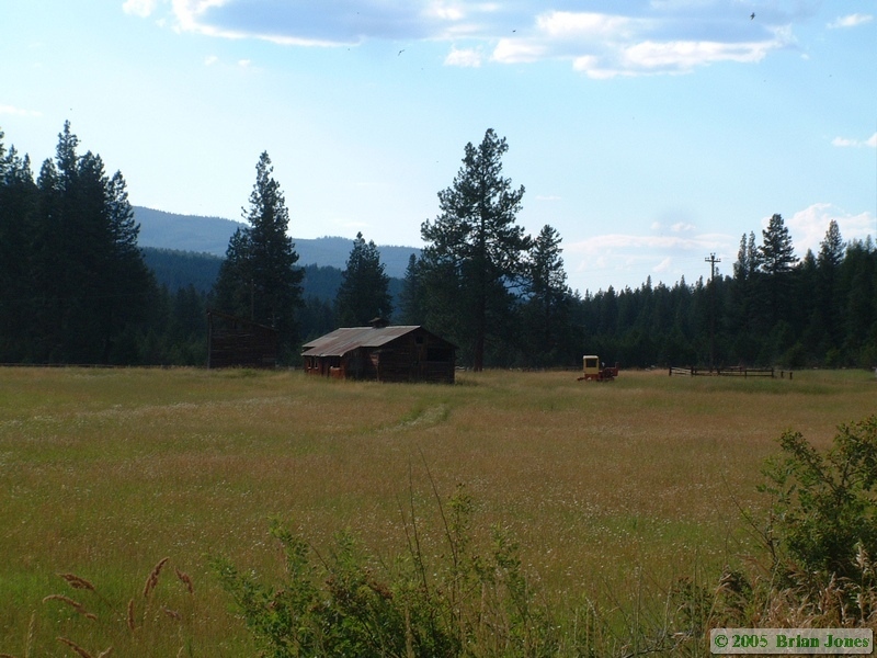
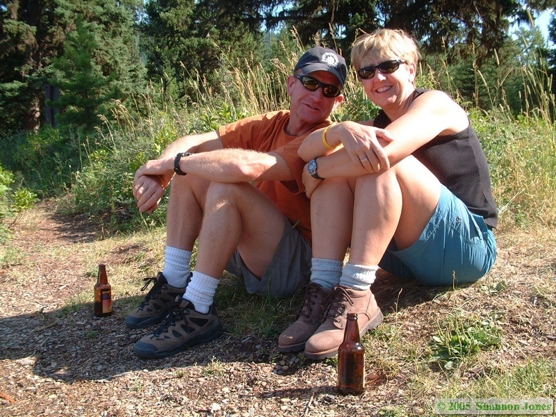
 Jerry and Andrea took us on a little tour of their property, which is really nice. They don't have their cabin built yet, but nearly everything is now ready for them to do so.
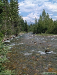
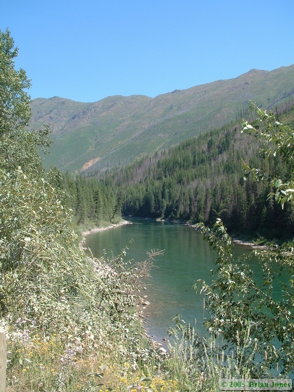
 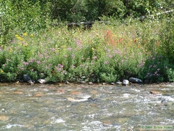 They have put a lot of effort into making the property look nice. Whale Creek runs in the back of the property, and from there you can see Pyramid Peak, which is in Glacier National Park. After the tour, we chatted for a while, then started going over and talking about the gear we were planning on bringing on the backpacking trip so we could reduce unnecessary duplication.
 Once that was done, I helped them cut down and trim up a tree that one of their neighbors was complaining about.
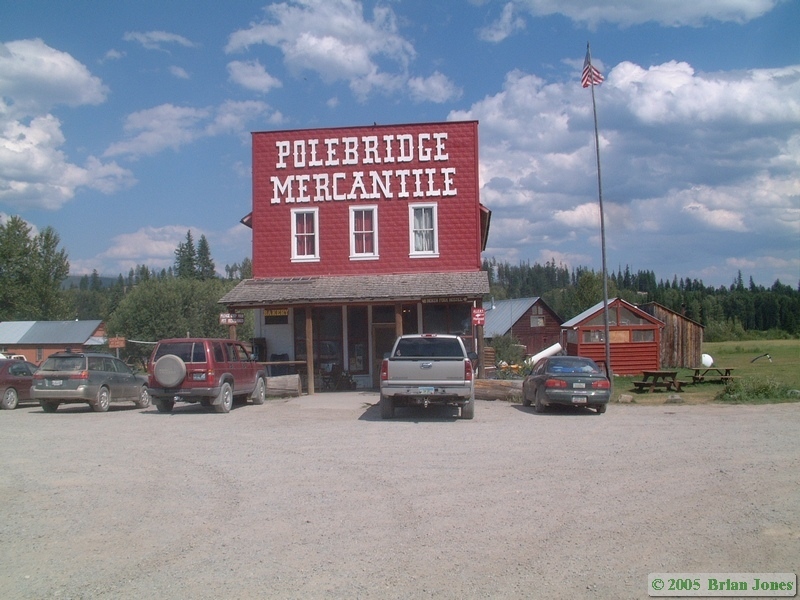
 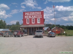 With that small task accomplished we headed to Polebridge. Shan and I arrived a few minutes ahead of Jerry and Andrea, so we went in to the little mercantile there. We were greeted with the odor of an amazing little bakery. It was the kind of unexpected smell that makes your eyes roll to the back of your head in rapture. We roamed the rest of the store thinking about what goodies we would buy before we left. We ended up with a dozen cookies and a couple of . . . of . . . flavored bread things. I got the focacia, Shan got a spinach, mushroom bread.
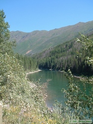
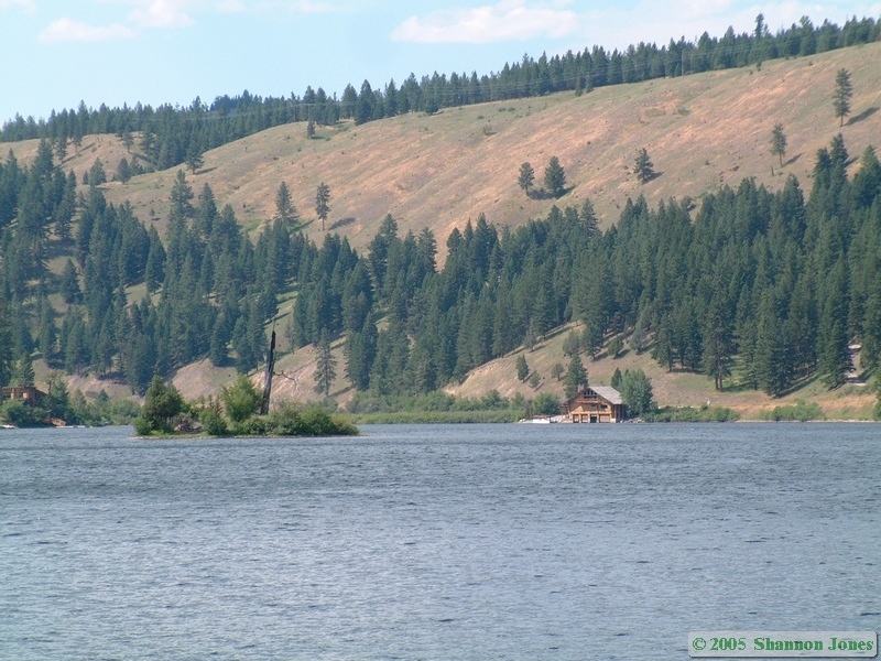
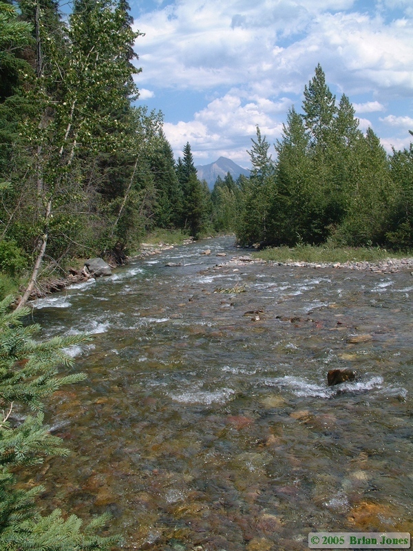
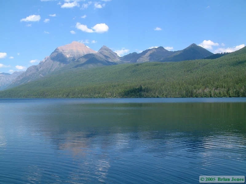
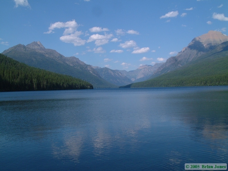
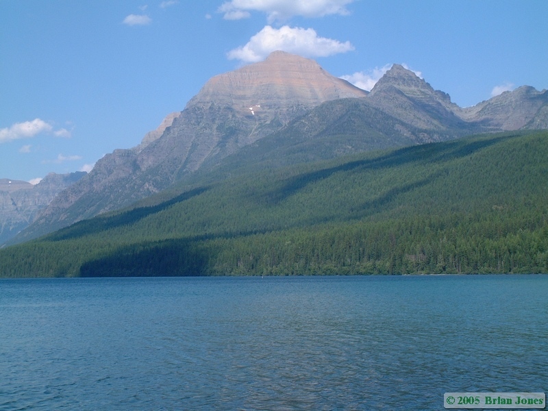
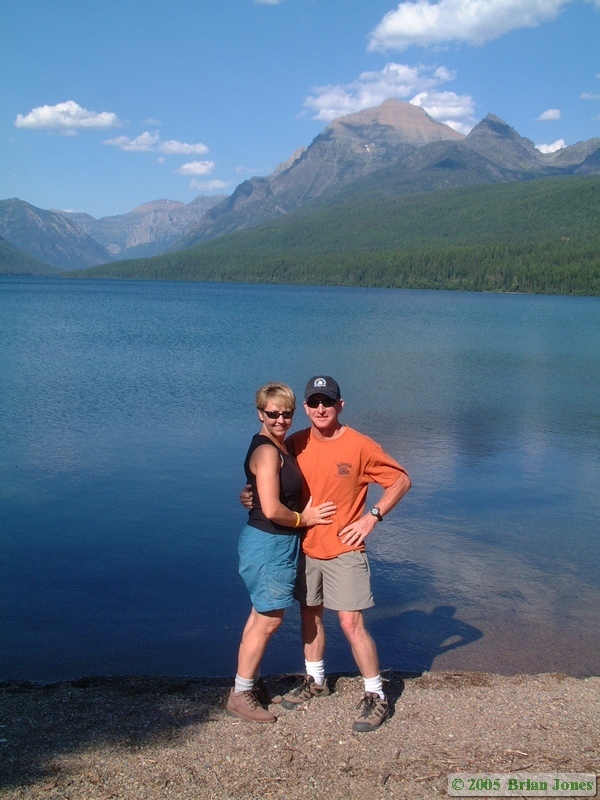
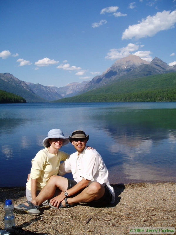
 After leaving Polebridge, Shan and I rode with Jerry and Andrea out to Bowman Lake, in Glacier National Park. It was absolutely gorgeous. We walked down to the lake and sat and talked for a while before heading back to Polebridge.
The plan was to have pizza at the Northern Lights Café in Polebridge, but when we got there it was an hour wait, and Shan and I still had a 90 minute drive to get to our B&B for the night, so we left. On the way to the B&B, we ate our bread things, and kicked ourselves for not buying a bunch to take on our backpacking trip instead bagels. The focacia especially was phenomenal. Shannon was jealous.
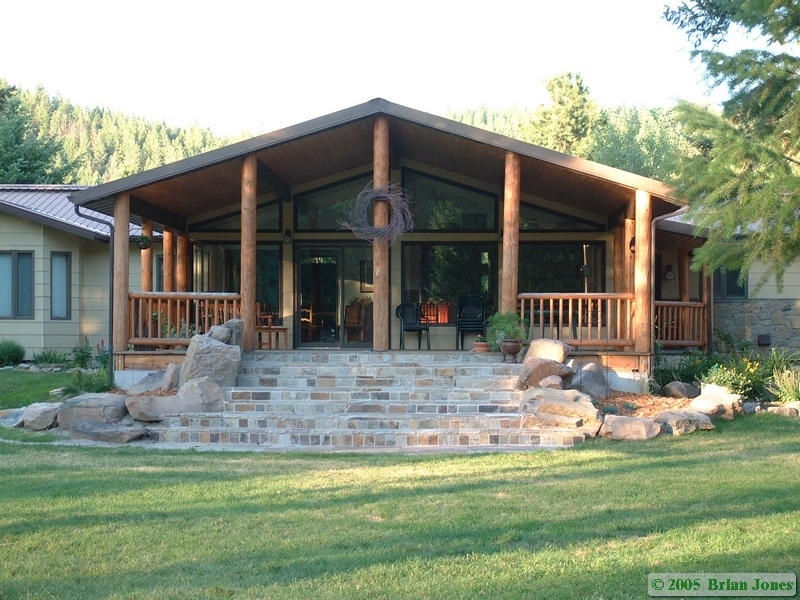
Friday night, we stayed at the Gasthaus Wendlingen B&B in Whitefish. The B&B is located on former farmland adjacent to the Whitefish River. The proprietors, Bill and Barbara were very nice folks who are rather avid outdoors people, so we had a fair amount in common. The house was quite nice and the setting was also very nice. Shan especially loved the robin's nest right outside the living room window, where we watched the parents continually flying in to feed their four very hungry young ones. While I was in the shower, Bill called Shan down so she could see a doe and her two very young fawns. We slept Friday night knowing that we wouldn't be sleeping in a real bed again for about a week.
Pre-Hike | Red Rock Lakes NWR kayaking | Clearwater Canoe Trail kayaking | Day 1 | Day 2 | Day 3 | Day 4 | Day 5 | Day 6
 Our drive north was quite smooth and uneventful, but still long. Except for one fairly short slow-up in Phoenix due to an accident, we made excellent time, and made it the 975 miles to Pocatello, Idaho in 15 hours, where we quit for the day. The next morning we had the free continental breakfast and hit the road by around 7:30. We continued north to Monida, which is right on the border between Montana and Idaho (get it? Mon-Ida?). From there we left the interstate and hit the dirt, heading east to Red Rock Lakes National Wildlife Refuge. It was from the border onwards that we discovered that Montana is the Derelict Building Capital of the World. They are the same time sad and fun.


