 This trip was supposed to be a kayaking trip down the Colorado River through Black Canyon below Hoover Dam with Jeff and Chuck, but when I called there weren't any launch permits for Veteran's Day weekend, so I had to go to plan B. The only problem was that I didn't have a plan B. I did some searching around for another potential kayaking locale, but nothing seemed quite right, so I made plan B a backpacking trip. Chuck isn't a backpacker, so that left Jeff and I. The question then became where to go. So I started searching around
for good places to go in November, came up with a few, then wanted to get Jeff's input. Well, Jeff works too much and unfortunately, sometimes pinning Jeff down can be like trying to hit a fly with a blow dart . . . blindfolded. Needless to say, the decision on where to go got made at the last minute, two days before the trip with a phone conversation that went something like,
This trip was supposed to be a kayaking trip down the Colorado River through Black Canyon below Hoover Dam with Jeff and Chuck, but when I called there weren't any launch permits for Veteran's Day weekend, so I had to go to plan B. The only problem was that I didn't have a plan B. I did some searching around for another potential kayaking locale, but nothing seemed quite right, so I made plan B a backpacking trip. Chuck isn't a backpacker, so that left Jeff and I. The question then became where to go. So I started searching around
for good places to go in November, came up with a few, then wanted to get Jeff's input. Well, Jeff works too much and unfortunately, sometimes pinning Jeff down can be like trying to hit a fly with a blow dart . . . blindfolded. Needless to say, the decision on where to go got made at the last minute, two days before the trip with a phone conversation that went something like,
Me: "Jeff, pick a number between one and 4."
Jeff: "Three."
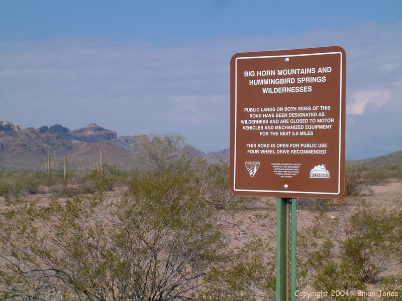
Me: "Great! We're going to the Hummingbird Springs Wilderness Area!"
Jeff: "Cool! Um. Where's that?"
Me: "Central Arizona."
Jeff: "Ok"
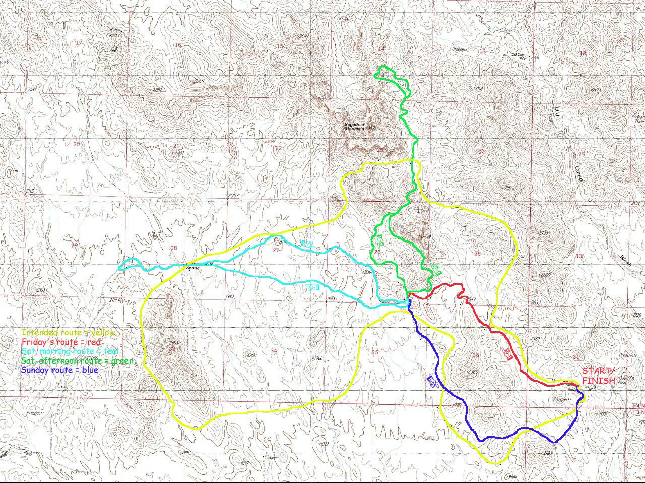
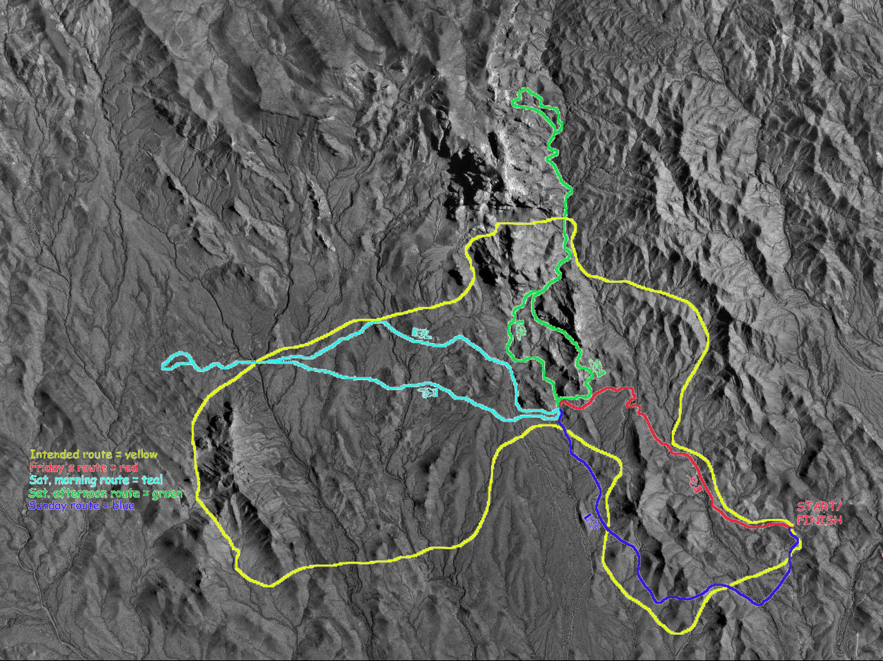
The great thing about Jeff is what he lacks in availability he makes up for in flexibility. I think it was during this conversation that he told me that his boss gave him a job to do on Thursday, but that he should be done by early afternoon so that we could at least drive up to the Wilderness area, investigate Hummingbird Springs to check for the availability of water, stash water if the spring was dry, and then drive to our departure location.
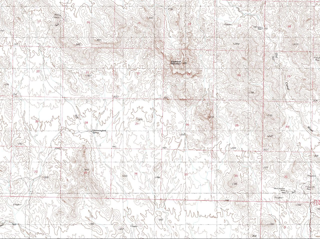
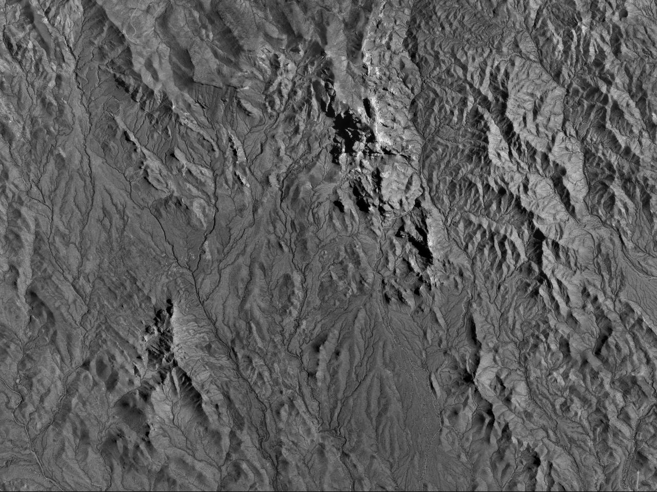
As Thursday wore on, the potential for driving up that day got dimmer and dimmer. When Jeff finally got done at seven o'clock Thursday night, we decided to head out Friday morning. So before even starting the trip there was already a wrench in my works. For you see, there really aren't any trails in Hummingbird Springs Wilderness Area. I had to create a route for us based on topographic maps and aerial photographs. And my route depended on us being able to start hiking by early to mid-morning on Friday. And there was no way of knowing how much we would have to alter the plan until we actually started hiking either. 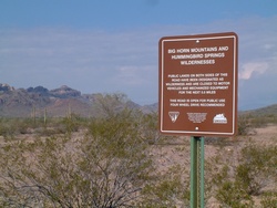 So on Friday, I picked Jeff up and we headed north. We exited the Freeway at Tonopah and headed west on Indian School Road about 4.5 miles, then headed across the desert on a small dirt road that took us under I-10, then on north over the CAP canal and in between Hummingbird Springs Wilderness and Big Horn Wilderness.
The recent rains were evident in the many mud puddles on the road, and eventually we made it to Hummingbird Springs. Well, we almost made it anyway. The map shows the road surrounded by wilderness but cherry-stemming all the way to the springs. But we encountered a gate about a half mile shy of the spring. The gate wasn't locked, but I refuse to violate the rules of Wilderness Areas. They are too precious to me. So instead of hiking to the spring, we decided to simply stash a few gallons of water near the end of the road so we didn't have to rely on the spring for our water supply. We then headed back out to go to our starting point at Moon Anchor Mine, also on a road that cherry-stemmed into the Wilderness Area. That's when we hit the second snag. Since I had so little time to plan, I didn't notice that there was no route to get from Hummingbird Springs to Moon Anchor Mine without going all the way back through Tonopah. Another wrench. So we got delayed even further.
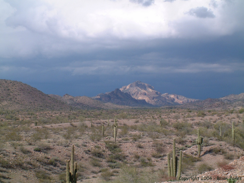
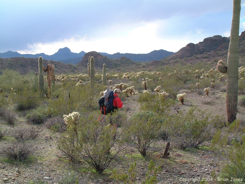
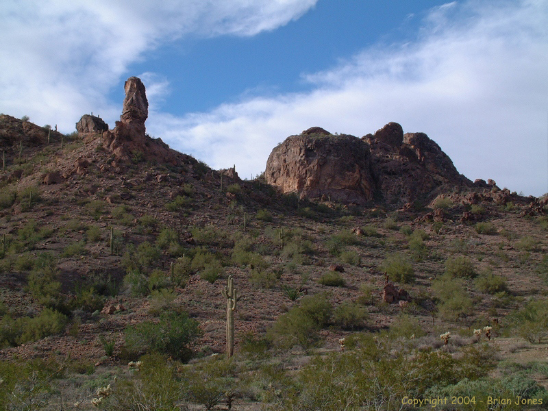
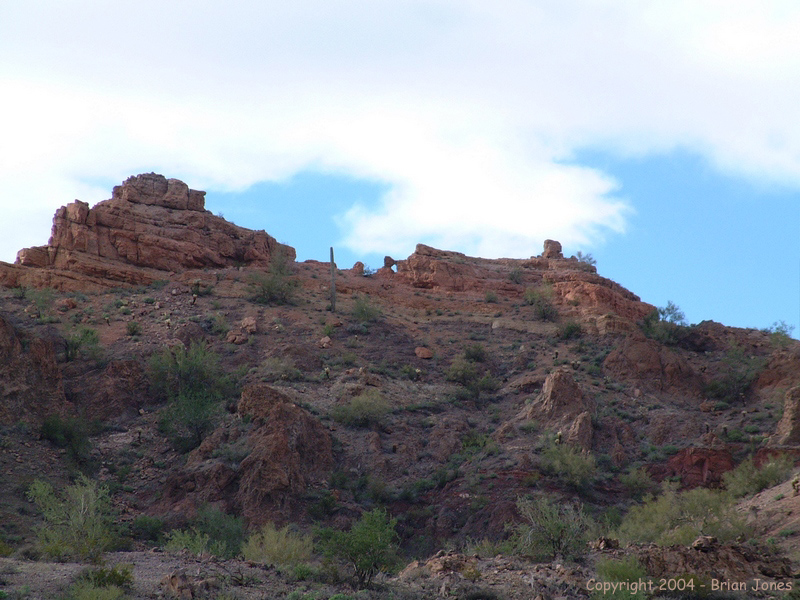
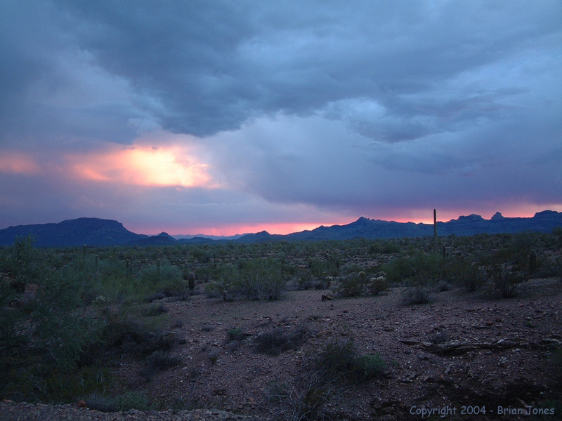
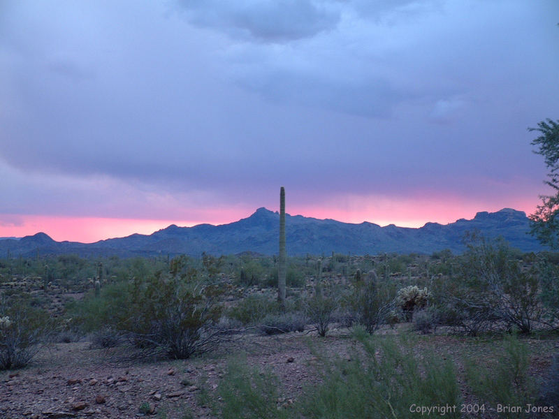
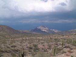 By the time we started hiking it was a little after two p.m. And the sky was threatening rain. Not ideal on either count. But we hoisted our packs and started north, with Sugarloaf Peak beckoning in the distance. The clouds were spitting a bit, so I hiked in my rain gear. That became too hot quickly though so the rain gear came off. The sky did open up with a light shower, but I didn't bother with the rain gear.
We found a few game trails to follow every now and again, but did most of our hiking across the open terrain. Even without trails, the hiking was pretty easy. The ground in the lowlands was rocky, but not overly so, and not the ankle-twisting kind of rocky. The only tough spots were when we had to get across some of the numerous washes that cross the land. Some were well incised and required us to hike up or down stream to find a place to cross with our heavy packs.
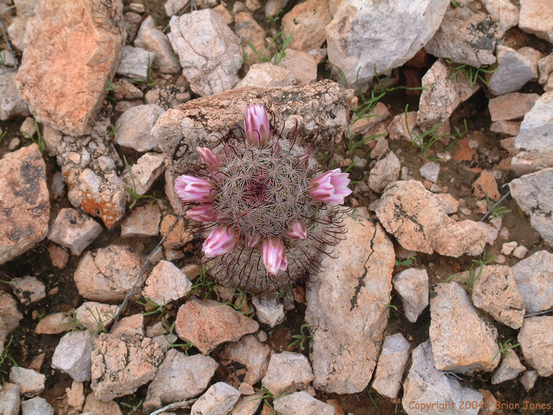
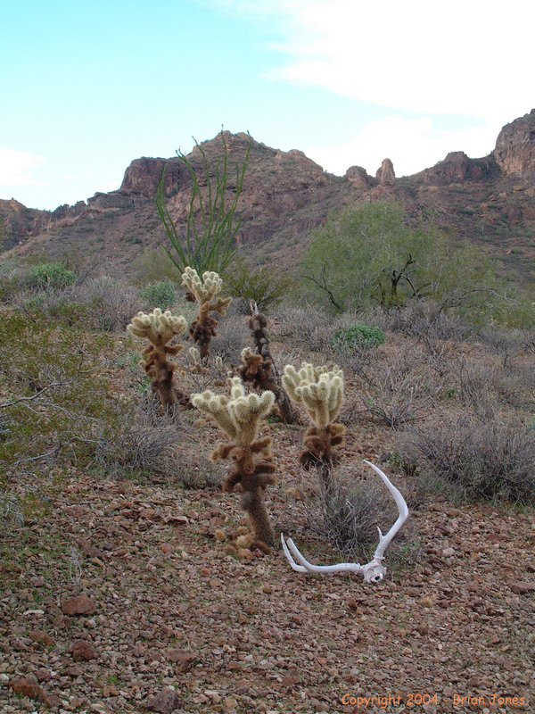
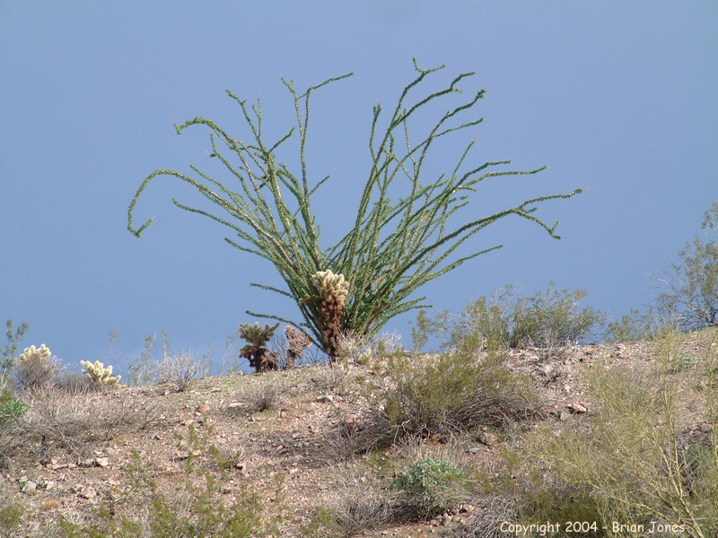
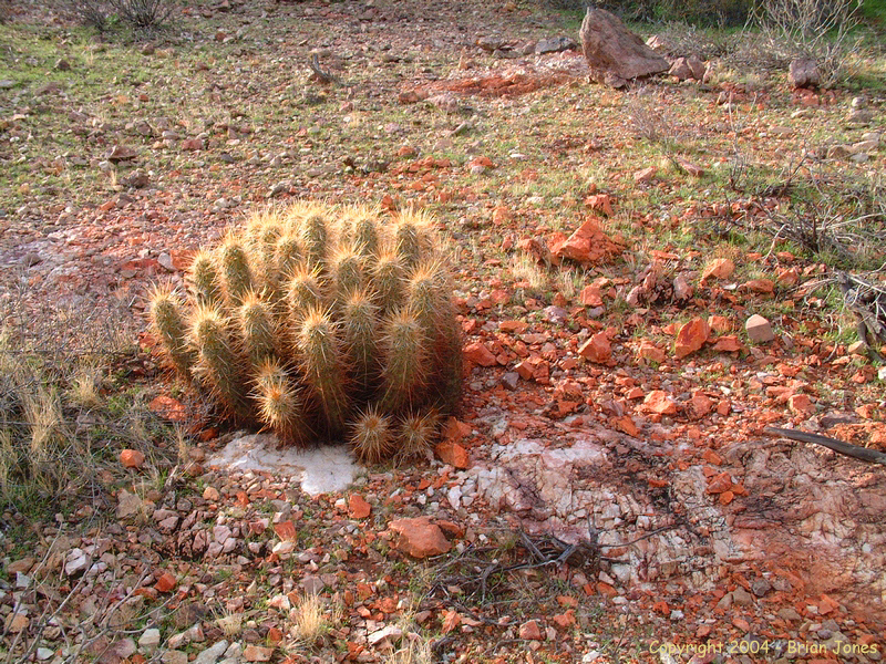
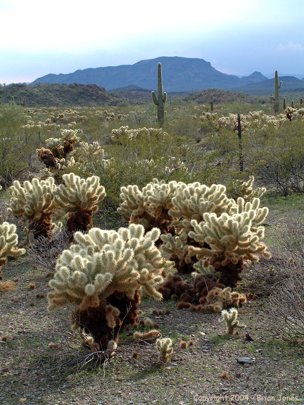
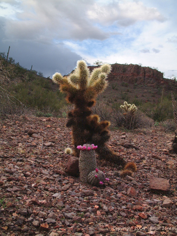
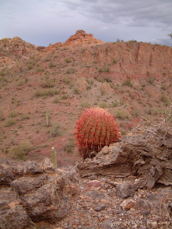
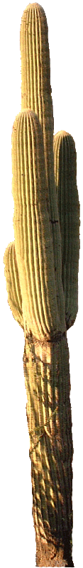
Along the way we saw a lot of cactus, including Pincushion cactus (Mammillaria microcarpa) in bloom, a mule deer (Odocoileus hemionus), and the head of a dead relative of that mule deer
(Onomyheadisgonus andiamdeadus).